GPO Marker Posts
Investigation
During the Coronavirus Lockdown from March 2020, my "hour of exercise close to home" took me exploring the streets around where I live. I've
walked around here for years, but my walks previously involved driving to the nearby countryside first. Those "lockdown walks" gave me an opportunity, without the
distraction of heavy traffic, to look more keenly at my surroundings - and I noticed some lumps of old iron that had evidently been there a very long time. They carried
royal crests and marks that looked like those I associated with the Ordnance Survey. They also carried distance markings in feet and inches, somewhat akin to Fire Hydrants.
I'd never noticed these before and was intrigued. I already had an interest in manhole covers and associated street ironwork, so these new markers fitted well with my
existing, if quirky, interests. Initially, I assumed they were Victorian (from the
VR markings) fire hydrants. It's a long story, but my investigations took
me via the Fire Service, Ordnance Survey, Telephone poles and general industrial archaeology groups, with lots of conflicting opinions and advice. Finally, I found a
page from a GPO publication that described in detail the later, concrete version of the
marker post - but included a reference and photo of the previous style: the cast iron posts that I was investigating. So here was "source" evidence from the GPO that
they "owned" these posts. Googling with increased confidence, I soon found about 50+ examples and was in communication with a number of individuals and groups who had
photographed or blogged their local posts. GPO Marker Post spotting was "
a thing"! I set to to share the results of what I'd found so far -
so gpo-markers.derektp.co.uk was launched.
The posts
Although the marker posts are undated, they carry the royal insignia of the reigning monarch, with the initials
VR for Victoria Regina - up to 1901;
ER
for Edward Rex (Edward VII 1901 - 1910) or
GR for George Rex (George V, 1910 - 1936). From before the end of George's reign the original design of cast iron marker
posts was replaced with concrete pillars; this site addresses only the cast iron version (for now at least!) I also suspect - but am not yet certain - that the iron versions
were solely for telegraph cables, and the concrete ones or telephones.

The distance numerals have, in very many cases, now been lost to the ravages of time; there is good evidence that some had their numerals removed during WWII to confuse any
potential invaders.
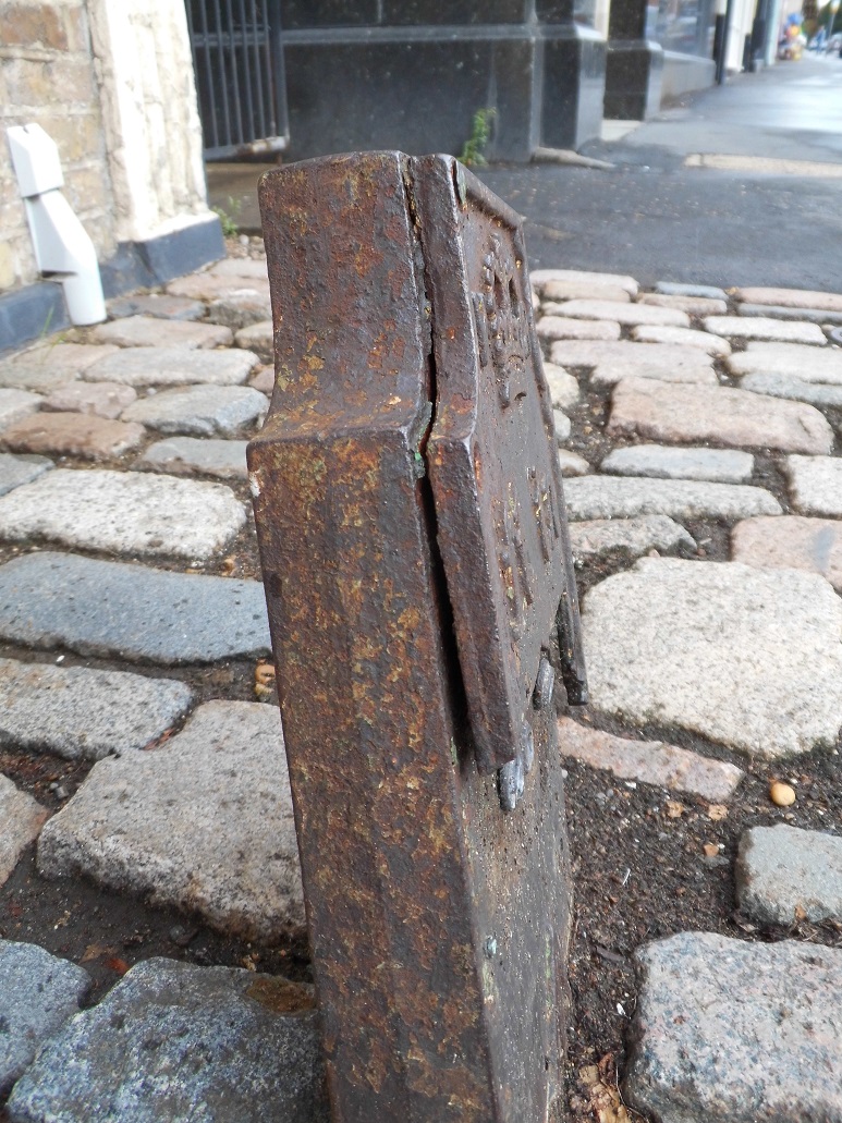
Originally many of the posts would have marked end-on cable joints, for which there was no footway box cover; the posts marked not only the joint, but exactly (to within
inches) of where to dig to find the cable. Marker posts from the three reigns are very similar, with the exception that the VR ones and early ER ones have the insignia
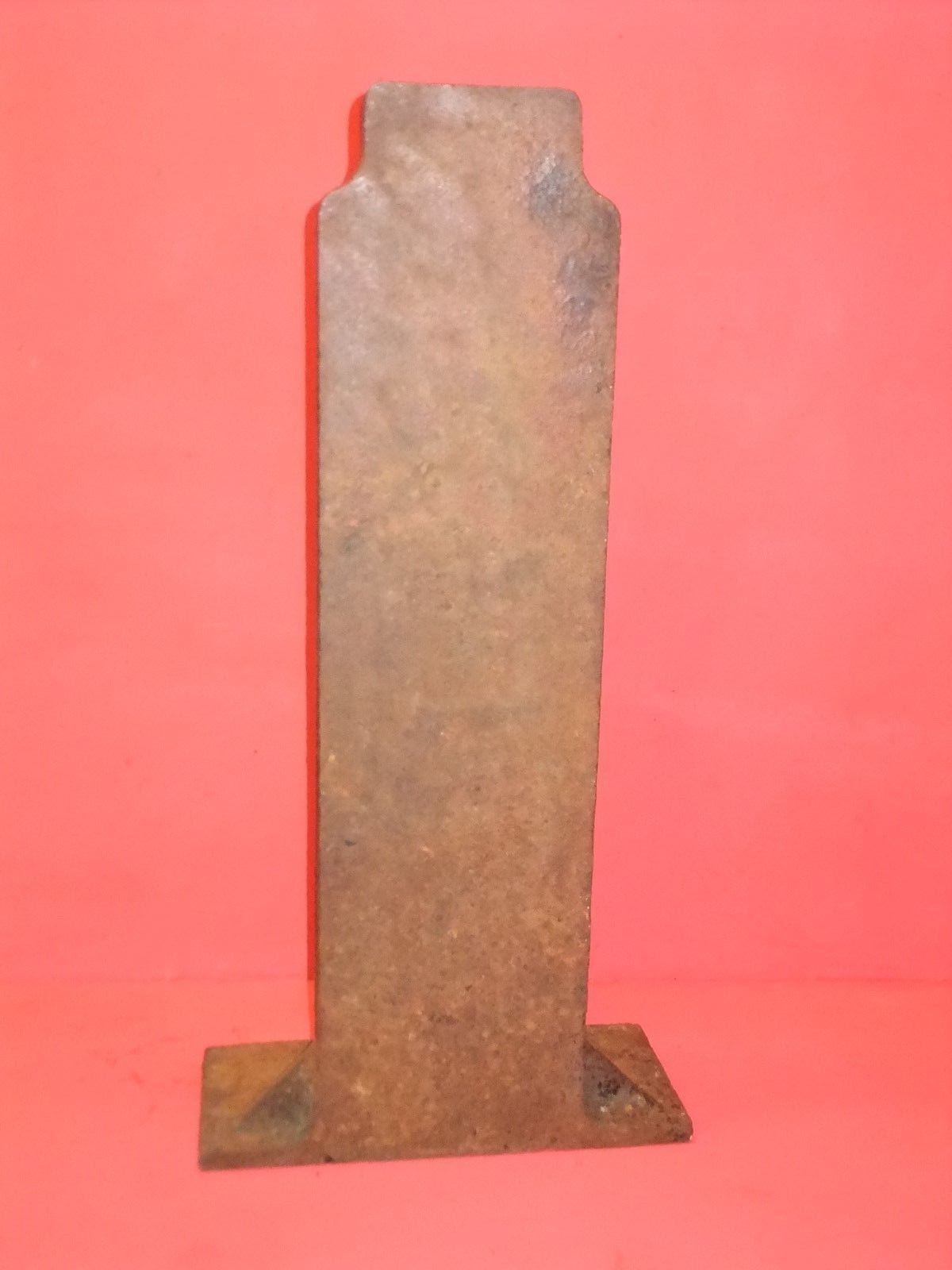
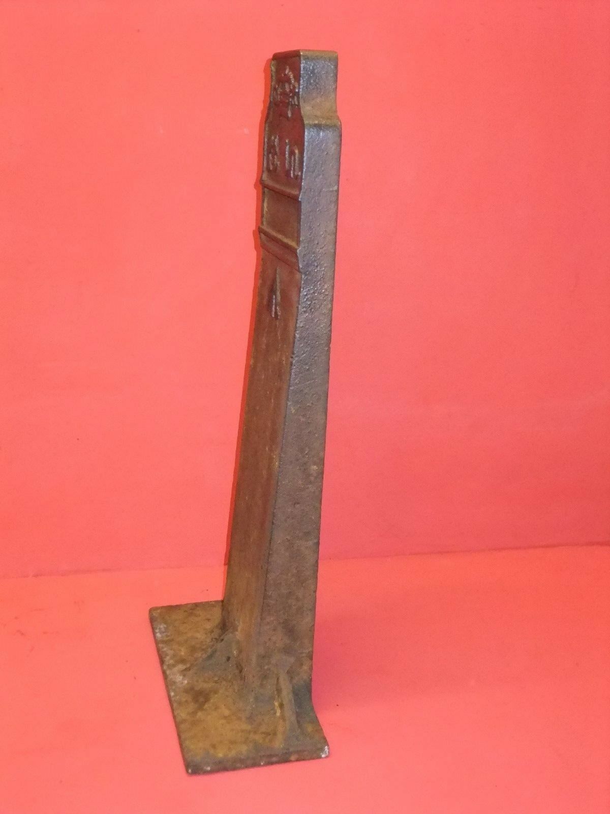
and "ft. in." marking on a separate "faceplate" bolted to the main body; in some cases these faceplates have been lost or broken. From the middle of the Edwardian reign
the design switched to a one-piece casting (hollow). Over the course of the past hundred years or so, changes to street levels have seen many posts either buried -
almost completely in some cases - or exposed more fully. This gives an interesting insight into how pavement levels changed, especially where the route followed originally
un-metalled tracks, later tarmaced and perhaps raised pavements added.

The "arrow" symbols that had misdirected me to an
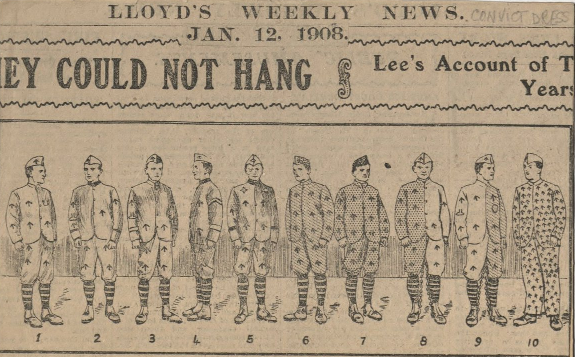
Ordnance Survey link are in fact a much more generic indicator of Government (originally Crown) ownership. The "broad arrow", as it is called, dates from the 17th
century and it remains illegal to reproduce the symbol on any goods without permission. You'll find the broad arrow not only on Ordnance Survey artefacts, but also
in other settings too - as in the prison uniforms of old.
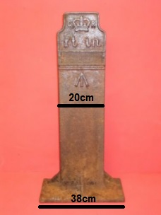
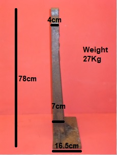
The posts are much taller than you might expect; they're buried deep and have a "foot" to prevent them simply being pulled out.
Finding posts
Anyone who's played
Geocaching will know the thrill of the "chase" and of finding a hidden geocache. Finding GPO
marker posts can be like that - but more so when you discover a previously undocumented one. Unlike Geocaching there are no clues, hints or co-ordinates; you need to
use your eyes alone. However, going armed with some of the following hints will help you locate posts.
- Posts follow the route of old cables, which tended to be along major roads; once you've found one, follow along the same road to find more.
They sometimes come in clusters or runs, often at intervals of 175 yards
- Plenty of old "POST OFFICE - TELEPHONES" manholes (or better still, "POST OFFICE - TELEGRAPHS") imply a major telecomms route of some age
- Search on roads that have not had their route changed, or been widened, since the 1930s.
- In town centres, they may be on much smaller roads that might once have been a shorter route, caused less inconvenience when digging up, or taken
a detour to a major post office (check on old OS maps for the location of these)
- Out of towns, markers are relatively rare, but might exist where a trunk route passed alongside a wall or past a farm; on "wild" verges they have
often been removed to avoid damage to verge-cutting equipment
- Marker posts are easiest to find when alongside old walls; stone walls are less likely to be rebuilt than brick
- Where many houses have paved over front gardens for parking, and demolished their boundary walls to provide driveways, marker posts may have been removed
- Remember that whilst some posts expose up to two feet, changes in road level may reveal more, though more likely less - sometimes only the top couple of inches
remain visible!
If you do find a marker post, use our search facility or interactive map to see if we already know about it. If we do, feel free to upload photographs or condition
reports; if not, then please let us know via the
Report form.
Incidentally, if you fancy an iPhone case with a GPO marker design, they exist!
See
here
(wrongly identified as a benchmark). Who knew! :-)