Post ID: 405
| Reign: |
VR (Victoria - up to 1901) |
| Numerals: |
None remaining
|
| Last confirmed: |
2 June 2026 |
| Location: |
St Nicholas' Church, Banbury Road, Warwick
|
| Depth: |
Buried to just below distance plate. |
| Condition: |
Faceplate damaged |
| Adjacent cover: |
Footway box cover adjacent. |
| Lat / Lng: |
 52.281284693,-1.582242079
Grid Ref:
SP 2859 6487
52.281284693,-1.582242079
Grid Ref:
SP 2859 6487
|
| Web Reference: |
www.warwickshireias.org/wordpress/wp-content/uploa...
|
| Identified by: |
Warwickshire Ind.Arch. Society |
| Streetview: |
|
| tilt=-15.17943150768100200
direction=97.36192932361107000
zoom=2.34159753883272100
|
| Added to database: |
15/03/2021 10:06 |
| Last updated: |
02/06/2026 19:54 |
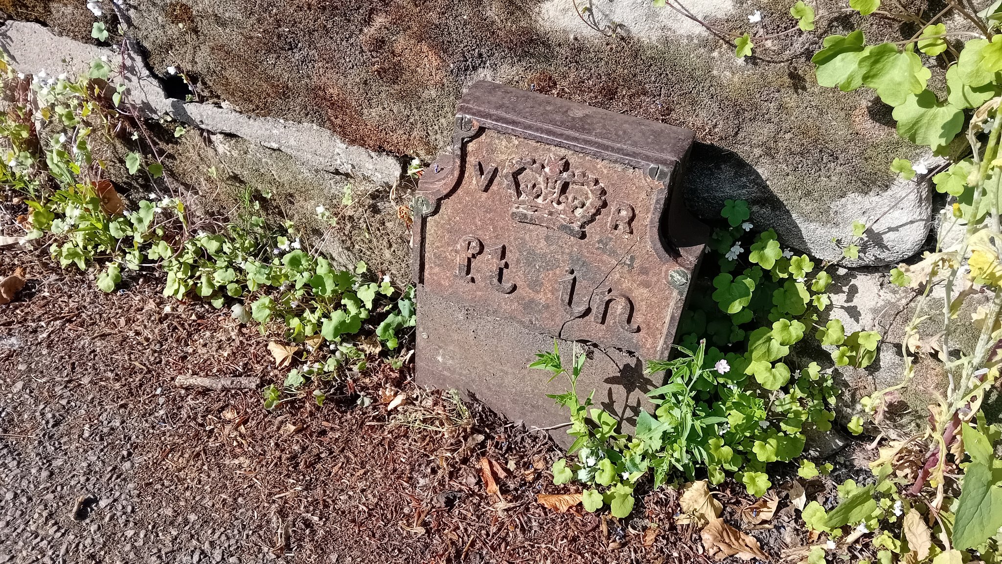
© Anth Rowley
Photo taken Jun 2026
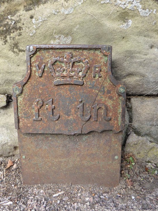
© John Brace
Photo taken Apr 2015
If you wish to contact me with feedback and suggestions for the GPO Markers website, please use the form
here.
If you have additional information or images of this marker, please
click here and complete the form.