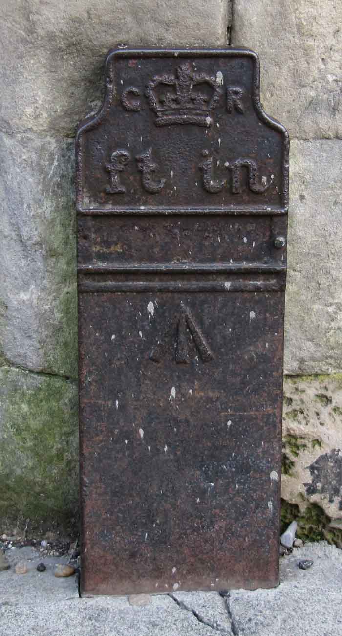
Post ID: 26
| Reign: |
GR (George V: 1910 - 1936) |
| Numerals: |
None remaining
|
| Last confirmed: |
June 2019 |
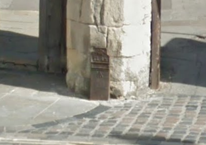
| Location: |
The Borough, Canterbury, Kent
|
| Depth: |
Buried to foot only; most of post exposed. |
| Condition: |
Body damaged |
| Adjacent cover: |
Footway box cover adjacent. |
| Lat / Lng: |
 51.281650274,1.082404965
Grid Ref:
TR 1505 5812
51.281650274,1.082404965
Grid Ref:
TR 1505 5812
|
| Notes: |
Between Aug 2018 and June 2019 top 6" has been broken off. Possibly more damage between 2019 and March 2021. Close to #24 |
| Web Reference: |
www.canterbury-archaeology.org.uk/gpo/4590809492
|
| Identified by: |
Canterbury Historical & Archaeological Society |
| Streetview: |
|
| tilt=9.29057050955887600
direction=19.60410321141533000
zoom=2.22964753700374600
|
| Added to database: |
31/07/2020 22:33 |
| Last updated: |
27/04/2026 23:17 |
© CHAS
© Google Streetview
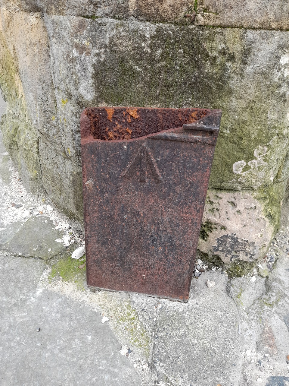
© Joyce Ainslie
Photo taken Mar 2021
If you wish to contact me with feedback and suggestions for the GPO Markers website, please use the form
here.
If you have additional information or images of this marker, please
click here and complete the form.