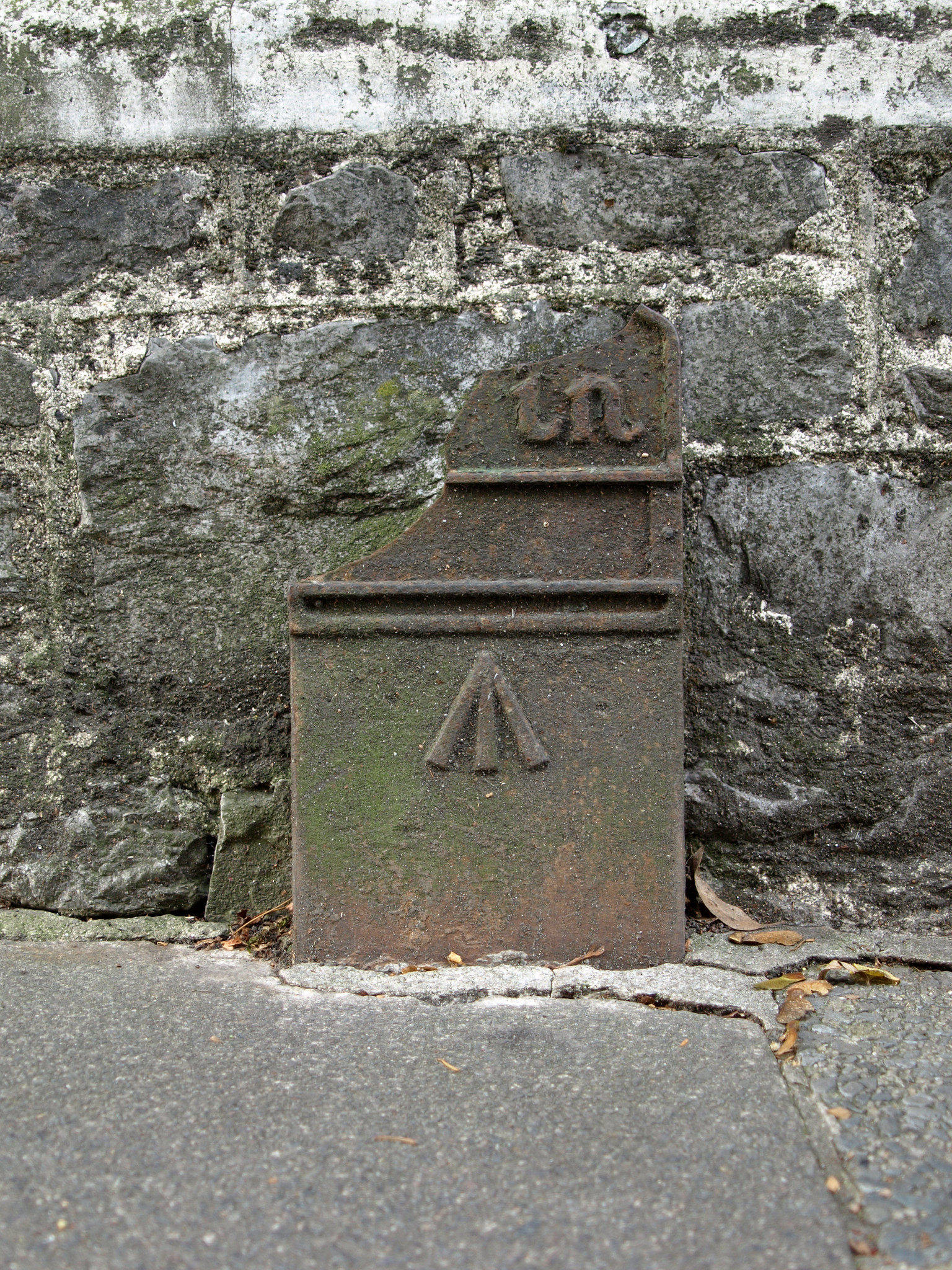
Post ID: 216
| Reign: |
GR (George V: 1910 - 1936) |
| Numerals: |
None remaining
|
| Last confirmed: |
November 2020 |
| Location: |
Mannamead Road, nr. Torr Lane, Plymouth
|
| Depth: |
Buried to just below broad arrow. |
| Condition: |
Body damaged |
| Adjacent cover: |
No adjacent box cover. |
| Lat / Lng: |
 50.393659226,-4.132696403
Grid Ref:
SX 4850 7038
50.393659226,-4.132696403
Grid Ref:
SX 4850 7038
|
| Notes: |
Plymouth Museum catalogue PPP-PMM TM 14; Footway boxes very close by but neither directly in front. |
| Web Reference: |
museumcatalogue.plymouth.gov.uk/details/collect/10...
www.flickr.com/photos/chrisinplymouth/15446693692/...
|
| Identified by: |
Plymouth City Council |
| Streetview: |
|
| tilt=-14.26130211527854000
direction=225.04038948556710000
zoom=2.37961023607557200
|
| Added to database: |
15/11/2020 10:49 |
| Last updated: |
27/04/2026 23:18 |
© Chris Williamson
Photo taken Oct 2014
If you wish to contact me with feedback and suggestions for the GPO Markers website, please use the form
here.
If you have additional information or images of this marker, please
click here and complete the form.